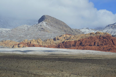
Our trip began in Las Vegas on February 22 and on the way out to Death Valley we drove through the Red Rock Conservation Area. Here, gray Cambrian limestone (the darker hills with snow) has been thrust over the reddish, Jurassic Aztec Sandstone. Total horizontal displacement on the Keystone Thrust is about 65 miles from west to east, although it took many millions of years for this displacement to occur. The snow made an unusual scene for this normally dry area.
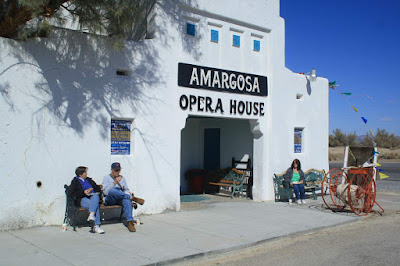
We needed to find protection from the windy conditions this day and found it at the Amaragosa Opera House and Hotel. This was our "worst" weather day and it was manifested only as 30 mph wind.
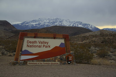
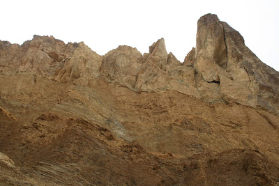
The northeast entrance to the largest national park outside of Alaska
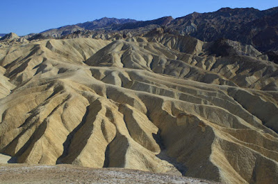
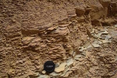
View of the Furnace Creek Formation near Zabriskie Point. These fine-grained deposits erode easily in the "flashy" runoff conditions of the Great Basin Desert.
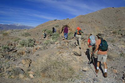
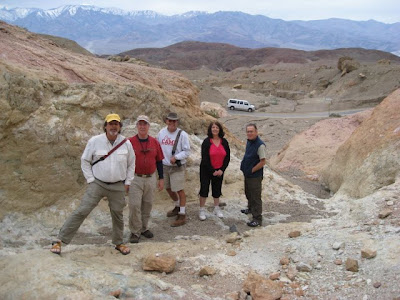
Our first hike on February 23 was over
alluvial fan deposits to the mouth of Fall Canyon in the Funeral Mountains
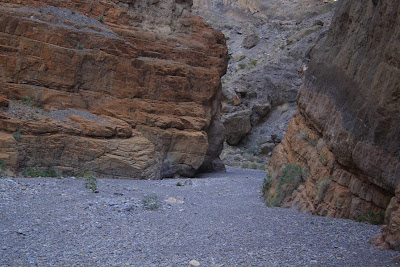
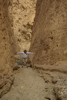
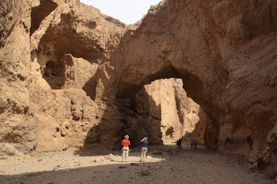
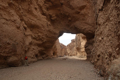
These are the narrows in Fall Canyon. The rocks are part of the Cambrian Bonanza King Formation, a western equivalent to the Bright Angel Shale and Muav Limestone in the Grand Canyon.
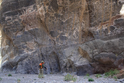
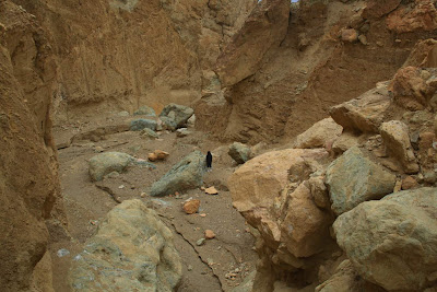
Admiring a large horizon of
breccia in the Bonanza King Formation. This breccia likely formed during one of the mountain building episodes that occurred in the area.
The narrows in Fall Canyon
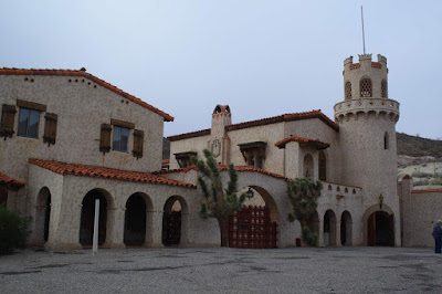
Scotty's Castle is an interesting diversion in a small canyon northeast of Fall Canyon
February 24 - We took the scenic Artists Drive and hiked in a canyon that was quite steep. A colorful mixture of rock types gives the area the name "Artists Palatte". The greenish rocks result from reduced iron and the brown colors are from oxidized iron.
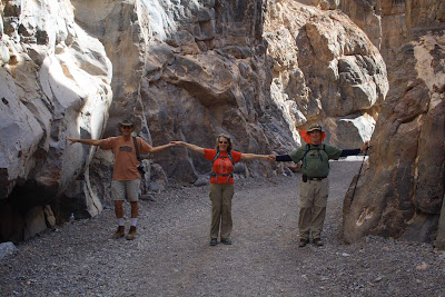
Jim's arms span the walls of this narrow canyon, cut into sandstone and shale of the Artists Drive Formation
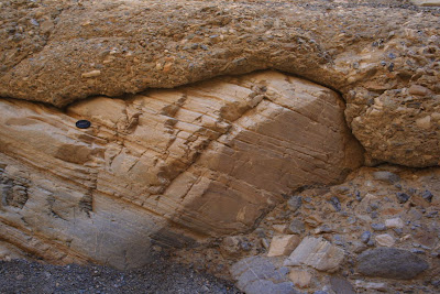
A close-up of these shales and sandstones, deposited in the initial pull-apart basin in Death Valley about 8 Ma
The sedimentary rocks (lower 2/3rds of photo) are overlain by dense welded tuff (obvious cliff on top). During the creation of this initial basin, volcanic eruptions blanketed the area with hot ash.
The Natural Bridge in a canyon in the Black Mountains of Death Valley. Note the original course of the stream bed to the left of the bridge. These relationships document very fast incision as the valley floor is lowered relative to the canyons that issue from the mountains.
View downstream of the Natural Bridge

Howard inspects the lower plate of the Badwater Turtleback. His hands and camera are on the surface of this fault. The upper plate rocks are not present here - they were faulted farther down into Death Valley. Lying on the
turtleback surface are recent gravels from the modern stream.
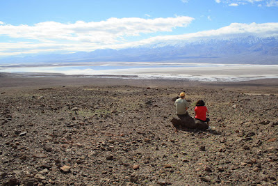
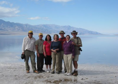
Steve and Carol admiring the view of Badwater and Death Valley during lunch.

Photo by Steve Keagy of his benchmark, placed on salt deposits at Badwater. This is the lowest spot on the North American continent, -282 feet.

Photo by Mary Clark Capito. Wayne and Howard high on oxygen below sea level. Or is it the geology exposed in this gem of a park?
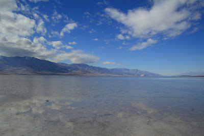
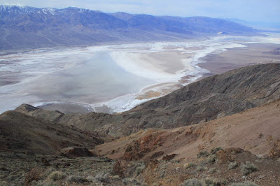
Badwater and the floor of Death Valley
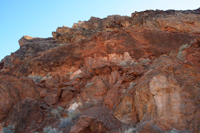
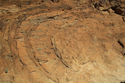
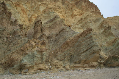
Chaos! We heard about the Amaragosa Chaos named by Levi Noble in 1941. These are rocks that have undergone four distinct periods of deformation, and thus looked like chaos to early geologists. We had to admit that the rocks looked very tortured and were glad we were not the ones who had to describe this mess.
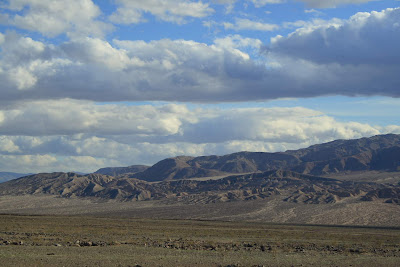
The Confidence Hills in southwest Death Valley
February 24 - A hike up Mosaic Canyon is always an interesting trip. The Precambrian Noonday Dolomite is partially covered here in cemented gravel from Mosaic Wash. Gravel from a flood filled and covered the rock, then was cemented by calcium when it was still buried, and then partially eroded to give this exposure.
Deformed rocks in the Noonday Dolomite in Mosaic Canyon. We had much fun finding the many areas where these rocks had been faulted, folded, squeezed, stretched and generally messed up.
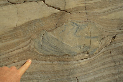
Look at this chert-rich "augen" in the canyon wall. During deformation (perhaps many miles underground when it occurred) this piece of rock was "rolled" into this position. Note that the augen is faulted as well.
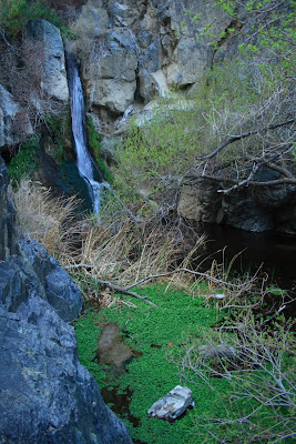
Yes - this is Death Valley too. It's called Darwin Falls and is located only a short distance from Panamint Springs
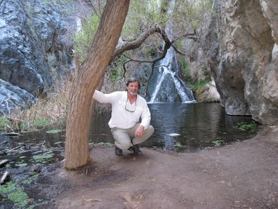
Photo by Mary Clark Capito of Wayne at Darwin Falls
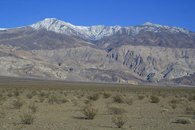
Telescope Peak (elev. 11.049) and the Panamint Range from the Panamint Springs Resort. The weather was awesome.
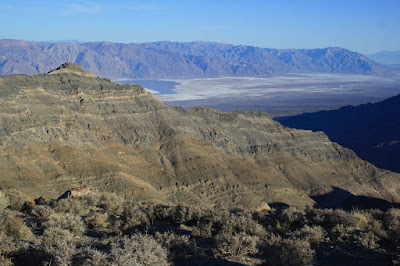
View southeast towards the Black Mountains and the floor of Death Valley at Badwater. This was taken from Aguerberry Point in the Panamint Mountains. The ridge in the middle distance exposes Cambrian and Ordovician strata.
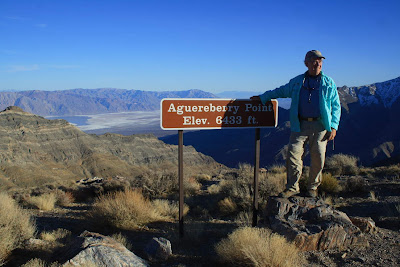
Howard in Heaven! Traveling to this high point was one of the highlights of the trip for all members of our group.
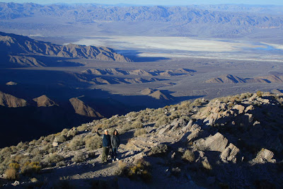
Looking northeast from Aguerberry Point towards the Mesquite dune field in the valley floor. We had walked in the dunes earlier in the day.
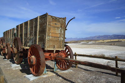
February 25 - The Harmony Borax Works north of Furnace Creek
Great view of the Furnace Creek Formation in Golden Canyon. These gravels were derived in fans from the western side of Death Valley about 6 million years ago. This means that the valley was not as deep as it is today. How else could the gravel travel to these east side exposures?
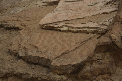
Ripple marks in the Furnace Creek Formation document shallow water conditions at times on the valley floor
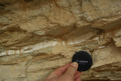
An outcrop of borate mineral in Golden Canyon
Our group hiking to borate mines near Mt. Blanco on the Twenty Mule Team Road
A final look of Death Valley from Dante's View. Badwater is visible on the valley floor and Aguerberry Point can be seen on the crest of the Panamint Mountains across the way.
Goodbye Death Valley! From Left to right, Wayne Ranney, Steve and Carol Keagy, Mary and Howard Capito, Janie and Jim Randall. We all enjoyed our geologic and scenic discovery of Death Valley and will return again!
 Norm leads the way with George, Bryan, Frank, and Bill following. Note the snow on the Four Peaks in the far background and the horizontal ash flow deposit in the middle ground.
  Our first nights camp was made along the J F Trail about 4 miles in. We had a good view to the east across Goat Canyon towards White Mountain. Reavis Ranch is located on the other side of this high ridge. I honor all of the old timers who called this wilderness home for so many years. They knew its secrets well and were lucky to have lived life in this special place.
 A self portrait at our first night's camp with the Four Peaks in the background. Arizona's Salt River flows from right to left in front of the Four Peaks but is out of view here.
 Sunrise shot across the Sups and the Four Peaks in the Mazatzal Mountains. The Four Peaks are composed of Precambrian igneous and metamorphic rocks.
 Nothing is better than sitting around the campfire with friends in a beautiful wilderness area
 Angel Basin is a spectacular area that is traversed by Roger's Creek. Normally dry, the creek this year was a rushing torrent and John and I actually went swimming in the creek. I interpreted the rocks seen here as being part of a vent complex in the Superstition Mountain volcanic field. These rocks had dominant vertical orientations and the many dikes that we crossed along the way here were all oriented towards this center.
 More spectacular vertical orientations to the rocks near our camp
 In a nearby alcove is the Roger's Canyon ruin, a Salado culture habitation site that was formally excavated in the 1920's and 1941. Although build well within an overhanging alcove, the ruin still had an enclosed roof from 700 years ago.
 Salado-age finger smears in the mud matrix of the walls of the ruin
 Inside the ruin, I used my flash to get a view of the intricate construction techniques used by the Salado builders between 1350 and 1425
  The view from the ruin upstream in Roger's Canyon. I have hiked down this stretch of canyon many times on previous trips. Note the shadowed wall on the right. These rocks are part of the vertical vent material that was part of the volcanic caldera. Note the horizontal ash flows illuminated in the sunlight in the center and left sides of the photo. These flows most likely made up the eastern slope of this 22 to 20 million year old volcano. It looks like the Roger's Creek drainage took advantage of the contact between these two deposits to establish its course.
 A pool of clear water in Roger's Creek. Curiously, three streams converge in Angel Basin making me wonder if a previous caldera basin might have attracted water flowing downhill?
  Sub-horizontal ash flow deposits observed to the north of Angel Basin
 Vertically oriented vent deposits to the south of Angel Basin
 On the way back out we camped along an unnamed stream that poured over a resistant dike. The J F. Trail from the Tortilla windmill seemed to take advantage of a resistant ridge of rock that was "held up" by a series of these dikes. I wonder if the cowboys of old knew that?
 Our intrepid crew, left to right below, John Shortridge, George Abbott, and Frank Romaglia. Back row left to right, Wayne Ranney, Norm Henderson, Bryan Brown, and Bill Leibfried. We do these backpacks at least once a year besides running rivers all over thew southwest. It is nice to have such a great group of outdoor enthusiasts to partake in these trips.


