Tuesday, September 27, 2016

Adventure in Iceland with Smithsonian Journeys - Part 2


Our Smithsonian Journey's Adventure in Iceland continued with a visit to the small fishing village of Husvik.

Everything is centered on the harbor and boys here.

We saw adverts for whale watching throughout the country and that is what we did with great success in spotting three humpback whales.

The blow from one of the humpbacks.

Another nice day for being outside - we were only 30 miles from the Arctic Circle here.

After whale watching, we were taken to what seemed to be a nondescript place inland from the north coast. A few towering columns of basalt were seen poking up through the colorful fall foliage but I had no idea what to expect since this was my first time to what used to be Jökulsargljufur National Park, the area now incorporated into the larger Vatanjökull National Park.

The areas is known to locals as Hljodaklettar (Rock of Echoes). Something astounding was to be learned here.

Okay - no more suspense. The river seen here is the same one as seen in the previous posting at Dettifoss waterfall, the Jökulsa a Fjöllum (Dettifoss is only eight miles upstream from here but we approached this place form a much different area). What is shown here is a dissected and greatly eroded subglacial volcano that was torn asunder by not one, but three glacial outburst floods, known is Iceland (and now worldwide) as jökulhlaups (literally glacial pools). The sequence of events here: 1) the pillars of basalt used to be be the vents of volcanoes that erupted beneath a glacier; 2) after glacial retreat, other subglacial volcanoes were erupted beneath the Vatnajökull glacier to the south; 3) those eruptions produced subglacial lakes that catastrophically drained, sending three huge outburst floods downstream, ripping apart the cores of the volcanoes here, and leaving coarse debris around them. Wow!

Dissected vent areas (rocks) inundated with outburst flood deposits. The largest flood is estimated to have been about 32 million cfs (cubic feet per second). For reference, the largest river on Earth today, the Amazon, has a normal discharge of one million cfs.

Not the multi-oriented joints in this volcanic neck, ripped open by the floods.

This is the specific place, Rock of Echoes, with it's eroded columns coated in calcium mineral as water has leaked out of the joints.

Detail of the differential weathering in the columns here.


I was standing perhaps 50 feet above the river here and could easily see the polishing of the basalt that happened when the floods roared by here. Flood dates are about 9,000, 7,000, and 4,000 years ago (post-glacial here).

Close-up of the outburst flood deposits. Very impressive! Both with respect to the size of the clasts and the thickness of the deposit.

View upstream of the rocks and fall foliage.

Overview from the top of the canyon looking upstream to the source area of the jökulhlaups. The floods likely overtopped the flat-lying mesas and carved there shapes into them. The dry canyon seen in the previous posting at Dettifoss also formed during these three floods.


Our time in northern Iceland had great weather and wonderful scenery (geology). Time to head to the south side of the island.

After our flight back to Reykjavik, we toured to Thingvellir (literally assemble field since this was the location of the meeting of Europe's first parliament in 930 CE). I think people would come tho this place just for that but the geologic overlay adds to the fun of coming here. The crowded walk marks the rift between North America (right) and Eurasia (left) This has been going on here for 180 million years, easily pre-dating the parliament meetings.

It was raining pretty hard when we stopped at Gullfoss (Golden Falls) and I have more photos of it from a trip I did here in June, 2015. You can see those photos as well as more from Thingvellir and Geyser (not included in this posting due to poor lighting and thus horrible pictures). But after seeing Hljodaklettar earlier on this trip, I was able to spot something here that I had not noticed before in all of my previous visits (and not maintained on any interpretive signs here).


Same photo annotated to highlight another outburst flood deposit that occurred here o this river system.

Being autumn, it was time for the sheep drive and we saw some impressive herding on our way south.

There are more sheep in Iceland than people.

And traffic must stop where they are crossing the roads.

This is not my photo but one from an exhibit at a farm that was affected by the 2010 eruption of Eyjafjallajökull (pronounced EH-ya-fedth-YO-kuhl). It is best to just look at the link provided about to remind yourself about this eruption that disrupted air travel for six days in Europe. If you would like to learn more about the family run farm that has this exhibit, click here.


Map of southern Iceland showing volcanoes (red outlines) and rifts (black lines).

Skogafoss waterfall near Iceland's south coast.

The Sólheimajökull glacier is called Europe's incredibly shrinking glacier as it has retreated one full kilometer up the valley in only nine years. See below. 


 This and the following photo are not mine but they do show the incredible retreat of the Sólheimajökull glacier. This photo is from 2007. The next one is from the same location in 2015.


Sólheimajökull glacier in 2015. My photo of the glacier two photos above was taken from along the far wall next to the lagoon.


Moving on the Vik on the south coast, we went to this area of wave washed basalt columns.

More sculpted volcanic vents could be seen and this area is a place that normally receives a lot of visitation. All of the post cards show these sea stacks in bright, sunny weather. We saw them in a different mood.

Bassalt columns are sort of the national symbol of Iceland.

Our last waterfall on the trip appeared to me like a green version of Grand Canyon's Deer Creek Falls. It is called Seljalandfoss.


It is possible to walk around behind the falls although there is some spray. The landscape of Iceland is rebounding upwards from the removal of the weight of the glaciers in the last 12,000 years and this is why the country has so many waterfalls.

A five story building was under construction in 2008 but an earthquake opened up a rift within the building footprint. Four stories were eliminated from the construction and in the one story visitor center, they highlighted the rift rather than filling it in and hiding it. Glass covered the rift with red lights (barely visible) portraying lava. Bravo - embrace the rift!

Reykjavik's "Pearl" framed by autumn foliage. The dome is a landmark within the city and the glass building is supported by six geothermal tanks, each with a capacity of one million gallons. The dome houses a revolving restaurant, a small café, and an outdoor observation platform with panoramic views of the city and bay.


A slab from the Berlin wall frames Hofdi House., where Ronald Reagan and Mikail Gorbachov met in October, 1986. This meeting is said to have ended the Cold War, or at least ended the first phase of the Col War.


Inside Reykjavik's Opera House. This concludes my postings from a trip to Iceland. If you'd like to join me on this adventure next year I will be leading another Smithsonian Journeys trip in June, 2017. See the information here.

My next postings will be soon and I will be reporting from the Annual Meeting of the Geological Society of America held in Denver. Thanks for reading.

Sunday, September 25, 2016

Adventure in Iceland with Smithsonian Journeys - Part 1

Iceland rocks! Of course, this volcanic gem will satisfy anyone with even a slight interest in earth history or volcanic processes. But what I mean is that this little island country, located just south of the Arctic Circle ,is experiencing a tremendous increase in visitation in the last five years. The number of travelers has jumped from 475,000 in 2011 to over 1,750,000 this year! The infrastructure is groaning and creaking as it tries to keep pace. What draws people is the lush countryside, enough modern conveniences, friendly locals, and the off-the-charts scenery (if you've ever joined me on one of my trips you will know that "scenery" is just another word for geology)! Iceland rocks!

I was leading a group of 24 lucky souls from September 10 to 21 on a fairly comprehensive journey to the west, north and south sides of the island. I visited many new places, even though I have been to Iceland many times before. The Smithsonian offers really great itineraries at reasonable prices. This posting will have two parts.

I will also be reporting from the Annual Meeting of the Geological Society of America in Denver the week of September 25.

This slide comes from my first of four lectures and shows the relative size of Iceland compared to Arizona. It is a significant chunk of real estate.

This shows all of our destinations on this trip. The blue line is an internal flight from the northern city of Akureyri back to Reykjavik. The trip starts in Reykjavik, travels north to Borgarnes and the Snaefellnes Peninsula, then n forth to Akureyri, Lake Myvatn and Asbyrgi, fly back to Reykjavik and journey to Thingphellir, Geyser, Hella, and Vik, ending again in Reykjavik.

Near Borgarnes, we visited this interesting spring that issues from between two lava flows. The water is channeled through the pores at the top of an aa lava flow.

Get ready to see some spectacular fall foliage in this posting - we seemed to hit it just right.

The Gerđeburg cliff. I will not be able to remember every Icelandic place name but this cliff is one of the most striking basalt columns we saw (and we saw a lot of columnated basalt).

Person for scale.

My friend Howard Capito joined me on this trip. Howard and I have been on about eight or nine trips together since 2007. I also had three friends from Sedona join me, and a past traveler from the 1990's in the Southwest.

Arnarstapi cliffs on a gorgeous late summer day. This cliff is located on the western tip of the Snaefellnes Peninsula. The place name is pronounced SNY- feth-nays.

Wave washed basalt columns.

Iceland is a land of rainbows. This one lasted 45 minutes.

Entablature cooling features in basalt on the Arnarstapi cliffs. When basalt lava cools, the upper part of the lava flow may cool in the presence of water, causing the joints to form radiating patterns. The lower, unwatered portion of the flow forms straight sided columns known as the colonnade.

Beautiful Snaefellnes Peninsula.

This is as good a view as we got of the Snaefellsjökull strato-volcano. This is considered one of the most dangerous in Iceland since a pyroclastic flow from it might cause a tsunami to roll 30 miles across the bay toward Reykjavik.

More Snaefellnes Peninsula. This is an eroded volcano along the shore with the vent area protruding as columns. Note the tuff layers to the right from this volcano. Most of the flows and cones on the Peninsula are less that 3.3 million years old.

As advertised, we were treated to the # 1 Icelandic specialty, hákarl, fermented shark meat. Much was made of the "delicacy before we arrived at the shark museum. (Check out the link above for the full details).

Our local guide, Gugga, gave us instructions which included chasing the delicacy with the local shnapps, brennivin. One can understand the need for the brennivin after sampling the hákarl.

Of course, I tried it. Have to, right? When in Rome.... At first it was chewy,  not too bad. But then the fermented ammonia aroma sets in and overwhelms the senses. I like a lot of exotic food and will try anything. The only thing that came to mind after trying this was, "But why?" If you did not read the link above, just note that the Greenland shark has very small kidneys and so it processes urine through its muscle mass. The shark meat is fermented for 6 weeks and then dried for 6 months - all done to get the piss out of the meat!

Drying racks!

Iceland is 85-90% volcanic rocks, including minor amounts of silicic rock types. It sits atop the Mid-Atlantic Ridge but also overlies a hot plume or hot spot. Here is a view some of the layers of lava, which began to appear above sea level beginning some 16 to 17 Ma. Interbedded with these volcanic rocks are lacustrine (lake) and fluvial (river) sedimentary deposits, representing periods of time of volcanic quiescence. Within these sedimentary rocks petrified wood of maple, beech and birch are found, as well as some mammal species. This shows that pre-glacial Iceland contained a rich tapestry of forests.

On the way to Akureryi we stopped at Vioimyrarkirkja Church, built in the 19th Century. However, Iceland has a detailed human history that stretches back to the year 871 CE (Common Era), when Viking pioneers set out from Norway and/or Scotland to colonize the island. Irish monks were likely already here living a life of solitude and contemplation. The Book of Settlement was written in the 12th Century and generally describes the people and history of Iceland's early days. A church at this spot has been in existence since the 11th Century.

Detail of the corner of the church.

The sod roof serves to insulate the building and doesn't need wood, which there was very little after the first 200 years of settlement.

Iceland's second largest city (18,000) of Akureryi, is beautifully located along one of the northern fjords. You can see we had great weather which is not always the case here.

On the way to Lake Myvatn.

Godafoss (Golden Waterfall) is one of the more well-known Icelandic falls.

In the Lake Myvatn area is a sub-aerial exposure of the MId-Atlantic Ridge. Note how the volcano has been rifted apart with the North American plate on the left and the Eurasian plate on the right.

Dettifoss (Sacred Falls) is an amazinglystrong force of nature and is considered Europe's most powerful waterfall.

It has an interesting geological story that will be explained more fully below. But for the time being, not the inner canyon and the outer canyon here.

Another view of the two canyons along the Jökulsá á Fjöllum river, the second largest in Iceland. This river originates from the Vatnajökull glacier to the south of here.


Selfoss (Silver Falls) along the river upstream from Dettifoss.

On the walk over to Dettifoss from the parking area is the abandoned canyon. The plot thickens and will be explained in Part 2.

Volcano in the Lake Myvatn area.

The geothermal  area of Námafjall near Lake Myvatn. I just love the smell of geothermal energy!

And I love a good boiling mud pool as well. This area has all of your geothermal needs.

Pseudo craters are formed when a lava flow over-runs a wet landscape like a marsh or lake. This happened here about 3,500 years ago and formed an incredible field of these strange volcanoes.

Pseudo crater in Lake Myvatn.

Another interesting feature is the pinnacles at Dimmuborgir. These formed when steam rose up in fumaroles through a lava lake - solidifying the tubes ofd the fumaroles. Amazing place!


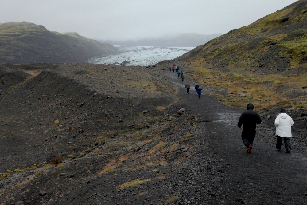
Walking to a pseudo crater on Lake Myvatn. This concludes Part 1.